Click on each chart for a larger version and to be able to zoom in to each state.
Station Plots |
Temperature Gradient |
Rainfall Gradient (9am - 9am) |
|
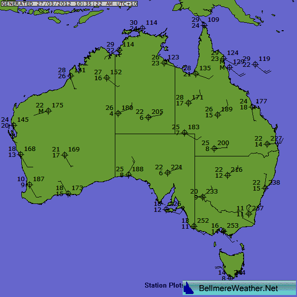 |
Station Plots |
Temperature Gradient |
Rainfall Gradient (9am - 9am) |
|
|
Updated: 1 Feb 2013 - 11:35 (AEST) |
Updated: 31 Jan 2013 - 23:35 (AEST) |
|||